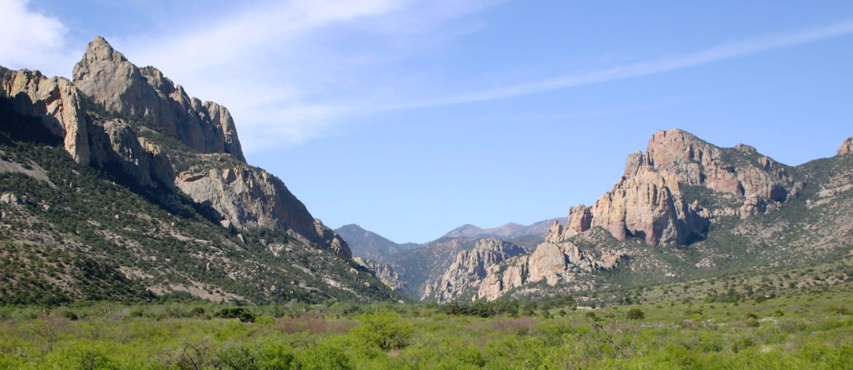
Portal, AZ - Rodeo, NM
Serving The Communities Of Portal and Rodeo (www.portal-rodeo.com)
Serving The Communities Of Portal and Rodeo (www.portal-rodeo.com)
Monthly Summary
Check Out The Arizona Drought Monitor
(Scroll down to the last photo)
Drought Monitor
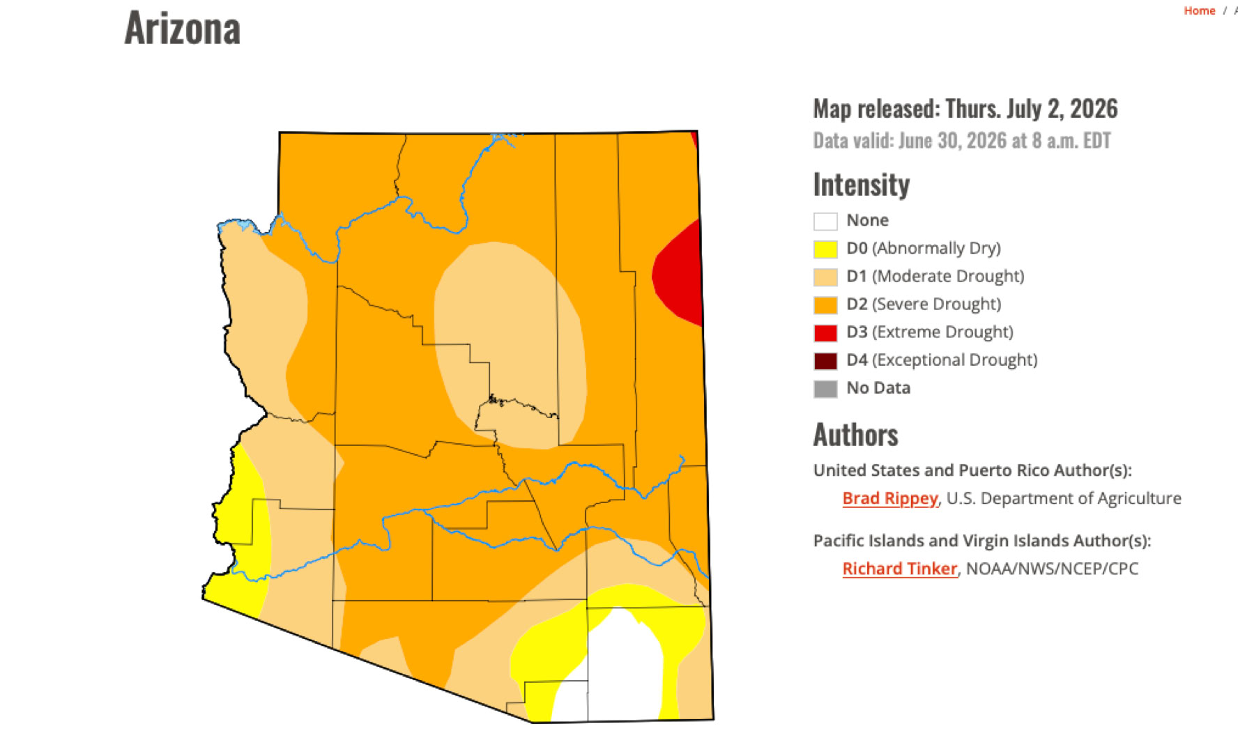
Check out the drought monitor and our recent haboob photos at the bottom of this page. Hooray - We moved up from Exceptional drought to Severe drought category.

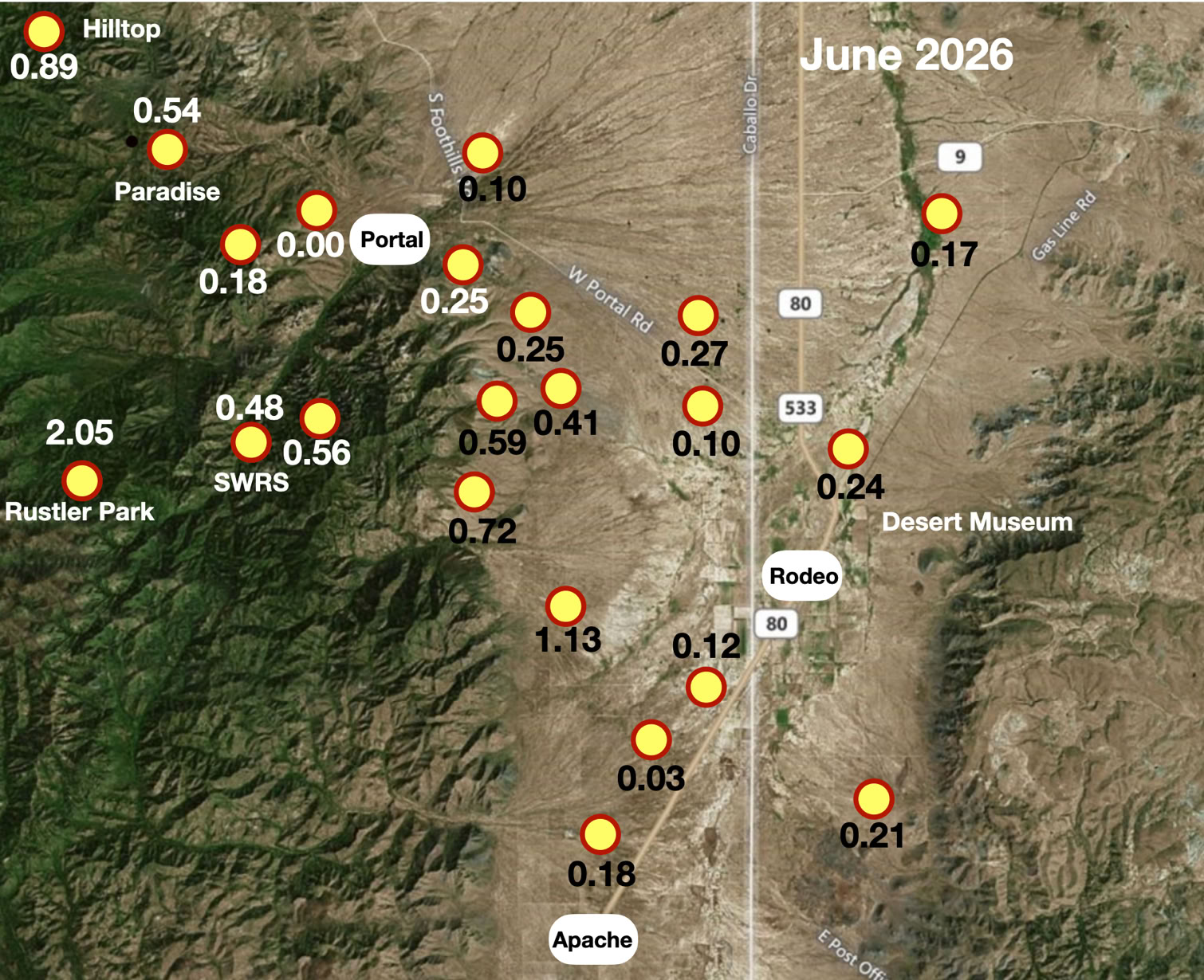
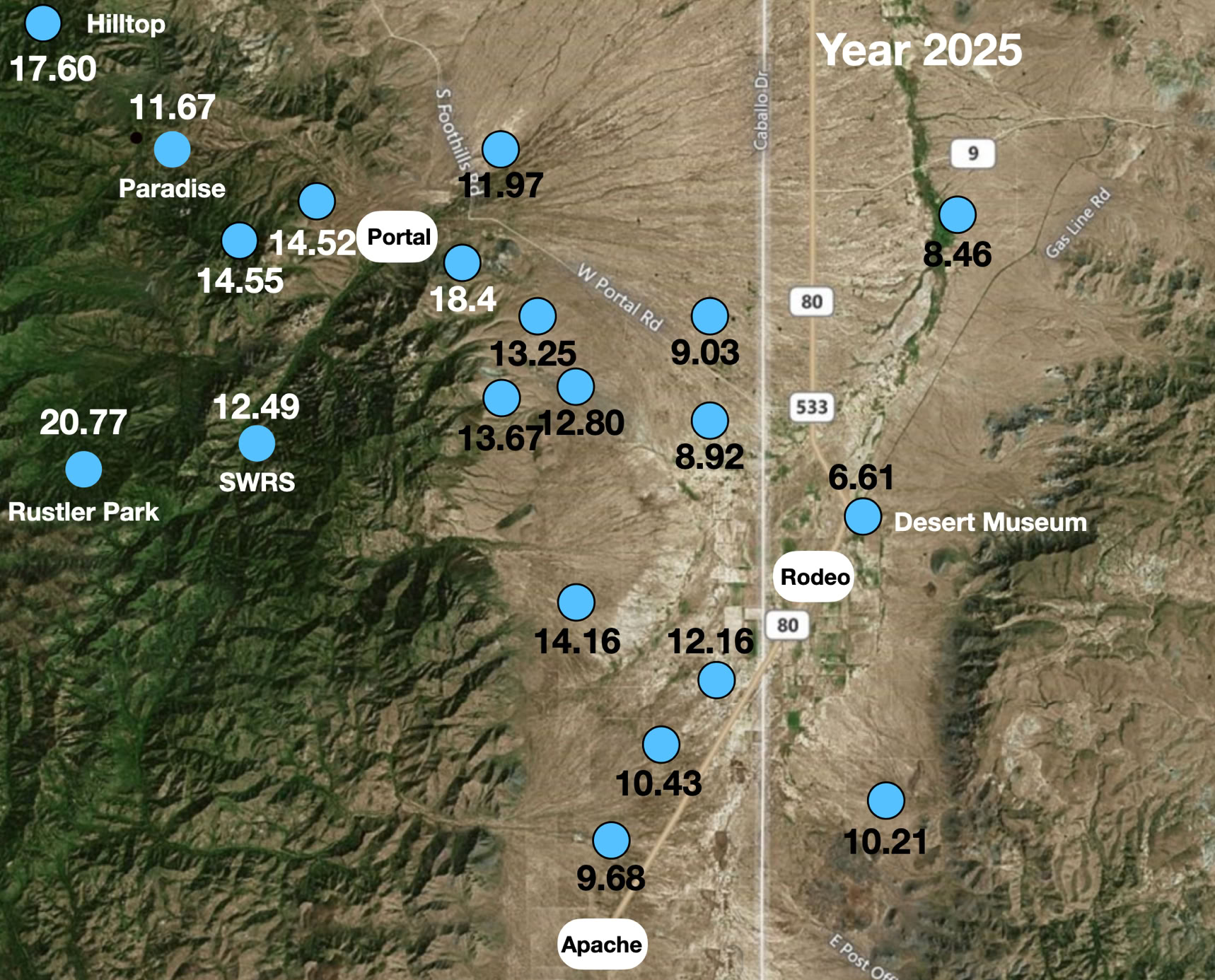
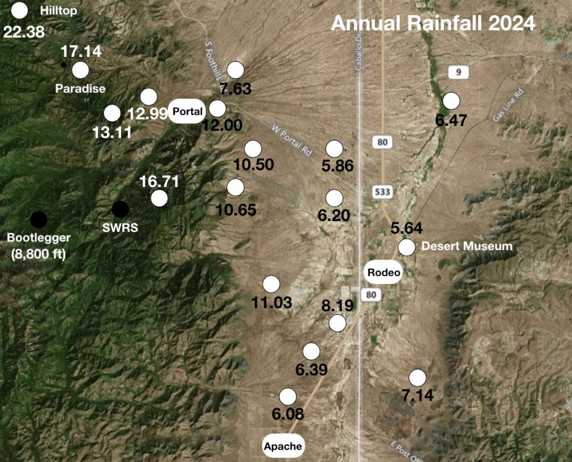
Year Totals - 3 Sites Over 10 Years
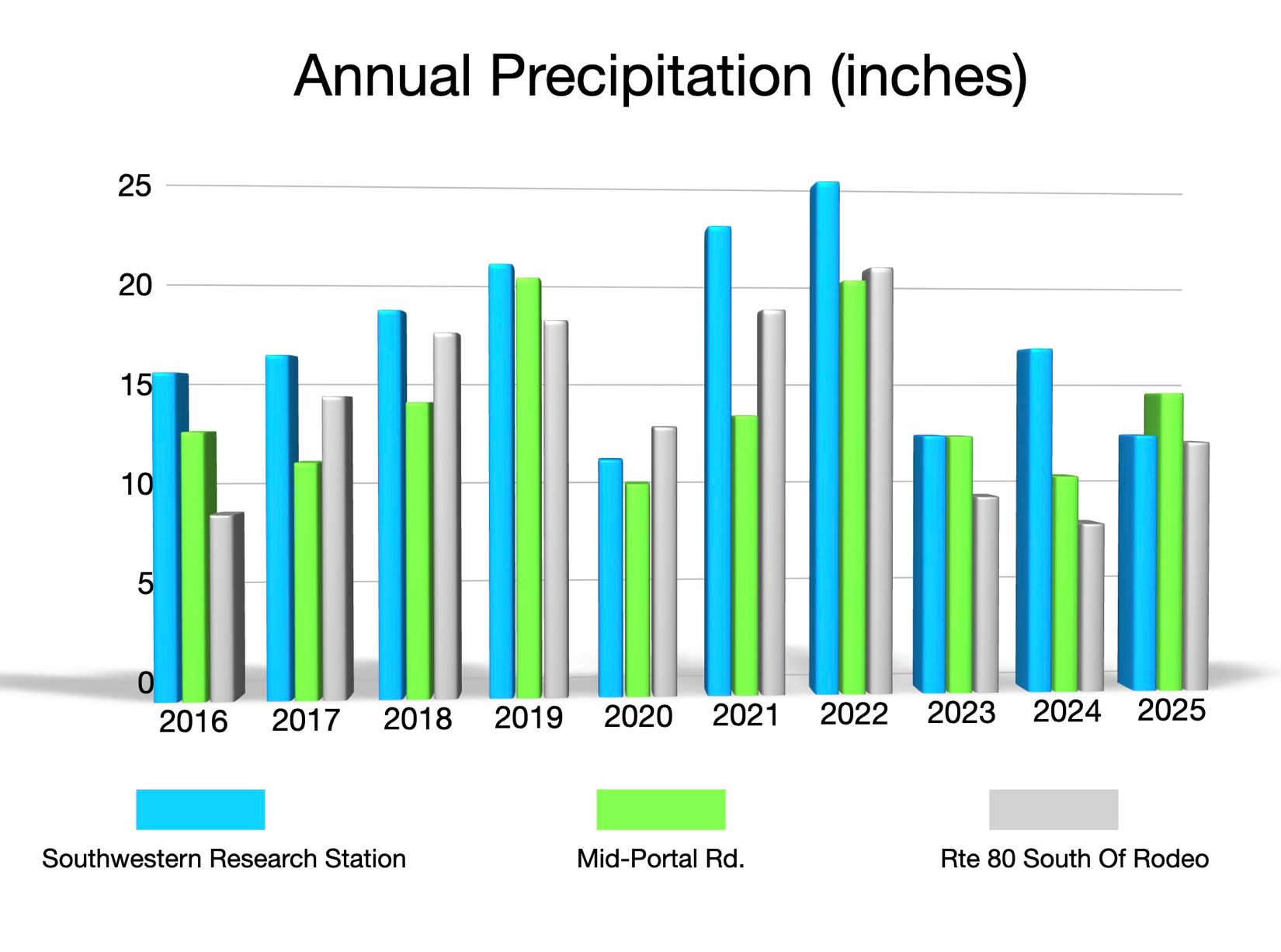
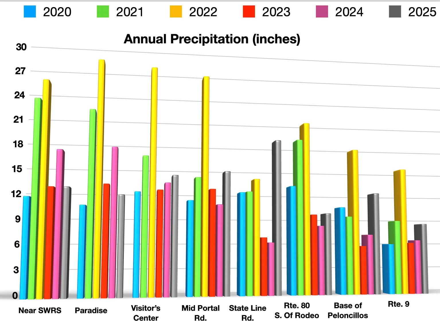
Year Totals - 8 Sites Over 6 Years
Ray Brooks’ 20 Year Log Of Cave Creek
For the past twenty years the longest dry run of the creek not flowing over Foothills Rd was 476 days ending August 10 2021.
That record was broken four days ago August 25, 2025 and is ongoing today at 480 days.
The longest wet streak of the creek flowing in that 20 year period is 271 consecutive days ending April 15, 2012.
Hurricane Odille in the Fall of 2014 made the creek run for only 105 consecutive days ending November 10, 2014.
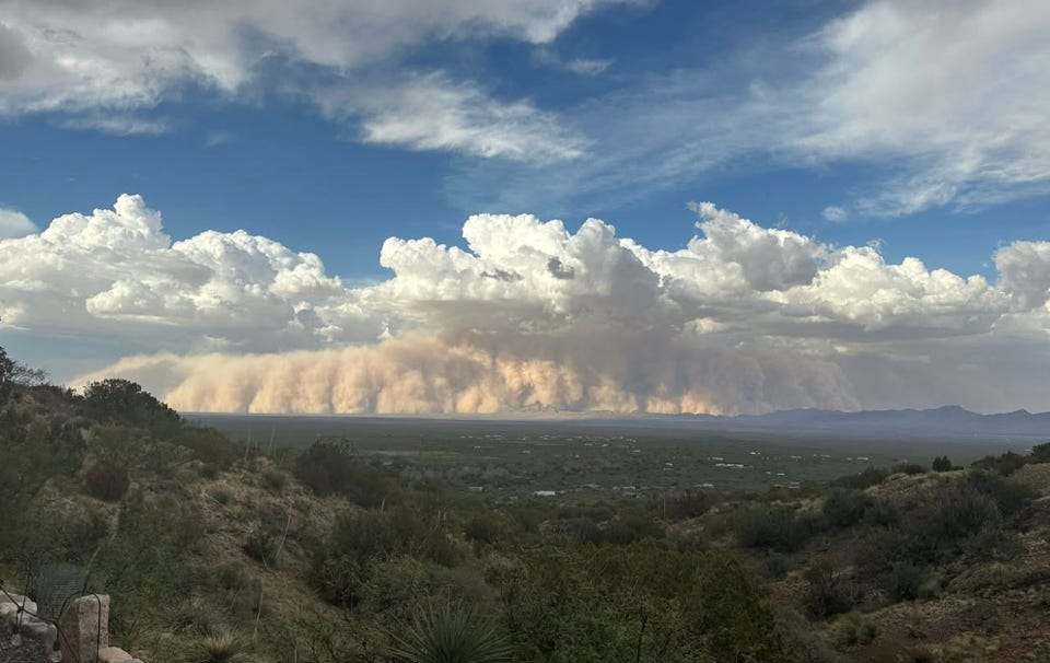
Haboobs - August 12, 2025
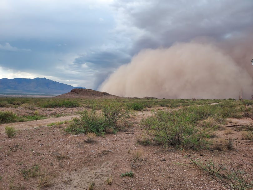
Tom Shields
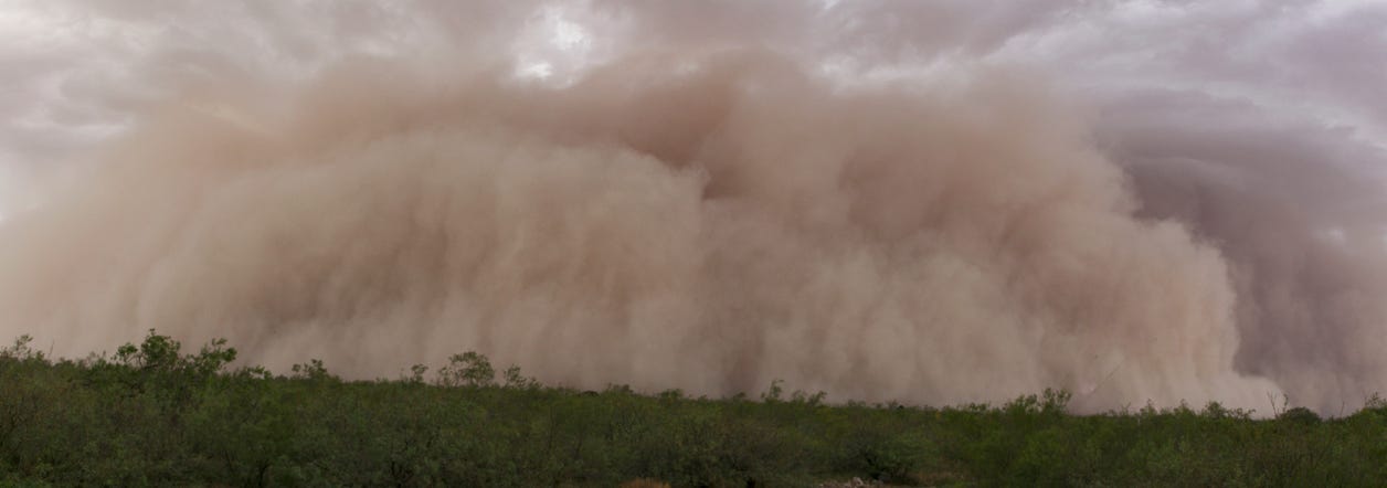
Steve Wolfe