Portal, AZ - Rodeo, NM
Serving The Communities Of Portal and Rodeo (www.portal-rodeo.com)
Serving The Communities Of Portal and Rodeo (www.portal-rodeo.com)
Hiking
July 23 - Rucker Canyon Trail
Meet at the Rodeo Post Office at 8:00 a.m. AZ, 9:00 a.m. NM
Carol Simon (520) 558-2433 casimon1947@icloud.com
Elaine Moisan (520) 558-5204 emoisan2011@hotmail.com
Elly Van Gelderen (520) 558-3715 or ellyvangelderen@asu.edu
__________________________________________________________________________
Click On Any Image To See It In Its Original (Larger) Size
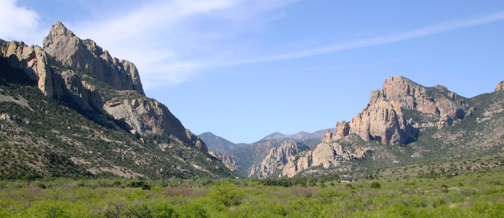
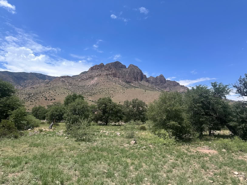
The monsoons have arrived in SE Arizona, and more rain is predicted. We had planned to hike the trail in Rucker Canyon this week, but the high probability of heavy rains caused us to change the destination. Rucker Canyon has the second largest watershed in the Chiricahua Mountains, so flood risk is real. There are many drainages to cross, any one in flood could block our drive home. Plus, I always feel bad driving 20 miles on muddy roads and leaving ruts for everyone else. So, we went to the nearby Sulphur Canyon:
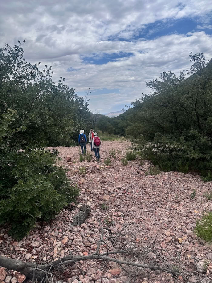
Sulphur Canyon doesn’t really have sulphur, it just has yellow cliffs that look like sulphur. There used to be a nice jeep road extending 1 mile on USFS land but after the Horseshoe 2 fire in 2011 and the Odile floods in 2014 the road is blown out after about 1/4 mile. We parked a little past the boundary gate and out of sight of the privately owned house, so the dogs wouldn’t bark at the car while we were away.
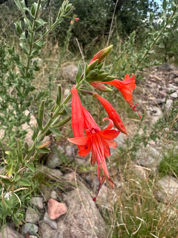
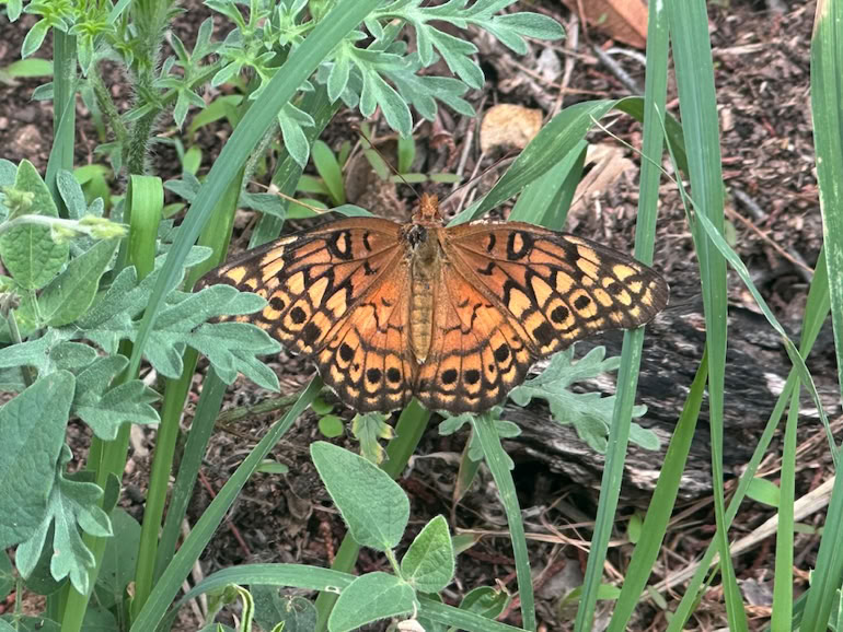
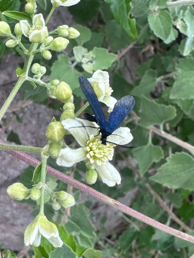
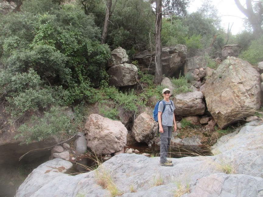
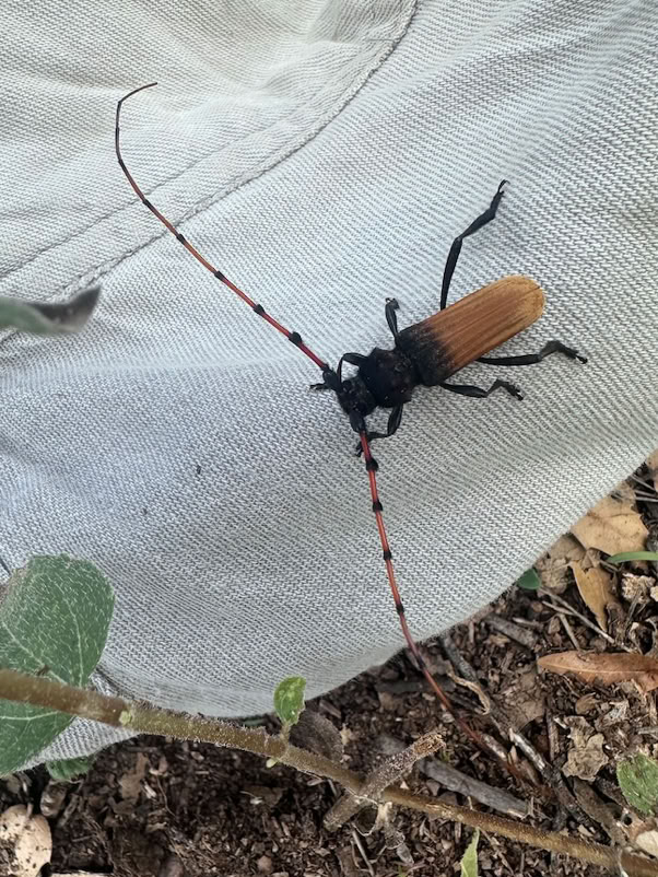
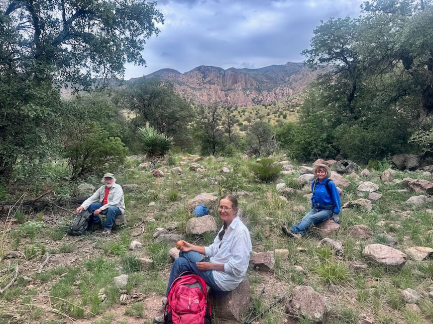
Sulphur Canyon is at low elevation, but the heavy overcast sky kept the day cool for the 4 hikers. Abundant perennial grasses have greened up here, giving the appearance of a managed park with widely separated large oaks and towering cliffs on both sides. With the recent rains, many beautiful wildflowers and insects were out:
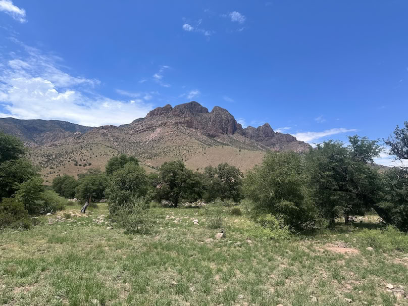
The old road soon ends at a major wash-out, and we continued upstream along the rancher’s black plastic water line. There’s a faint trail the whole way to a developed spring, water storage tank and cattle trough. This was the end of the original jeep road.
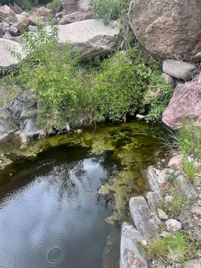
We continued up the canyon on an old trail now used primarily by cattle and wild critters. The oaks and junipers are thicker in the upper canyon with little understory. It is a pleasant hike under the tree canopy. We continued upstream to where the canyon narrows - about 1 1/2 miles. There are 2 large side canyons where cobbles had been deposited across our route, and the going was a little rough. We stopped for an early lunch at pools of water where the canyon narrows to the width of a single trail then goes onto bedrock
Willow and ash trees suggest perennial water is present in the soil. Clouds were building as we ate, and we turned back going the way we came. Rains didn’t hit Portal until a couple hours after we got home but would have gotten us had we gone to Rucker.
Next week we will again plan for Rucker Canyon, but we might need to change if the weather stays wet (please keep raining - everyone needs more). Meet at the Rodeo PO at 8 AZ, 9 NM. Remember lunch, water, hat, rain gear, sun protection (boo !) and boots that can get muddy, Rucker Canyon is a longer drive so prepare your family for a later return if we go there.
Hike report from Al, Photos from Elaine
Easy Trails
Moderate Trails
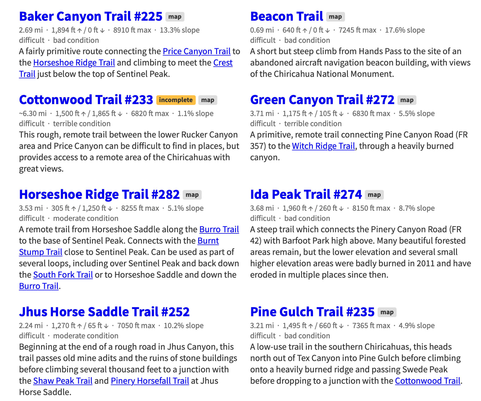
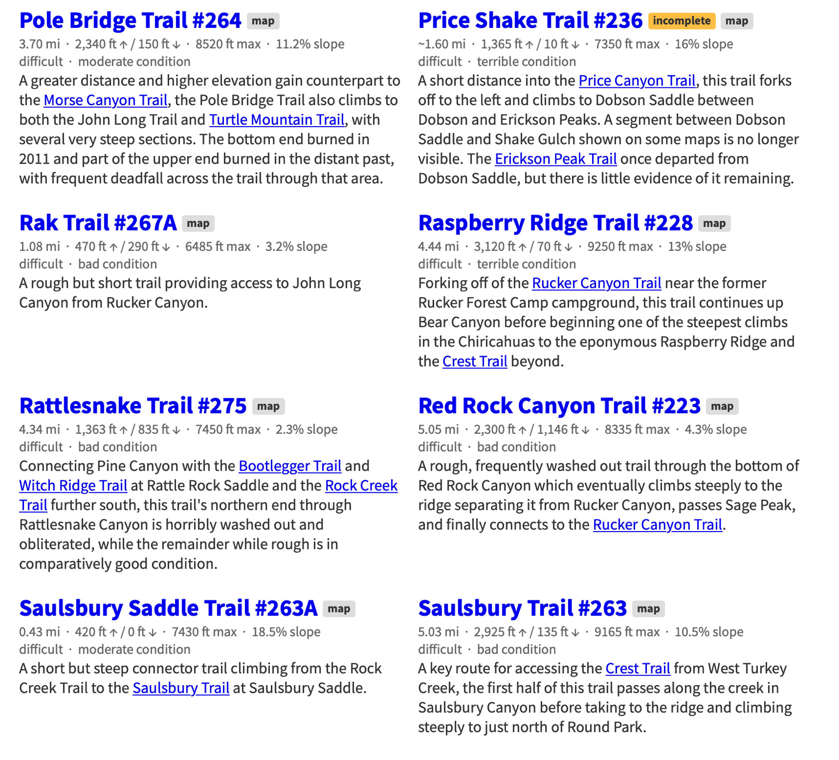
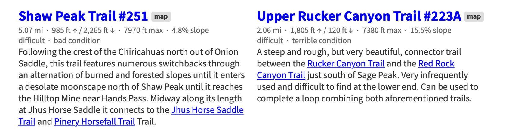
Difficult Trails
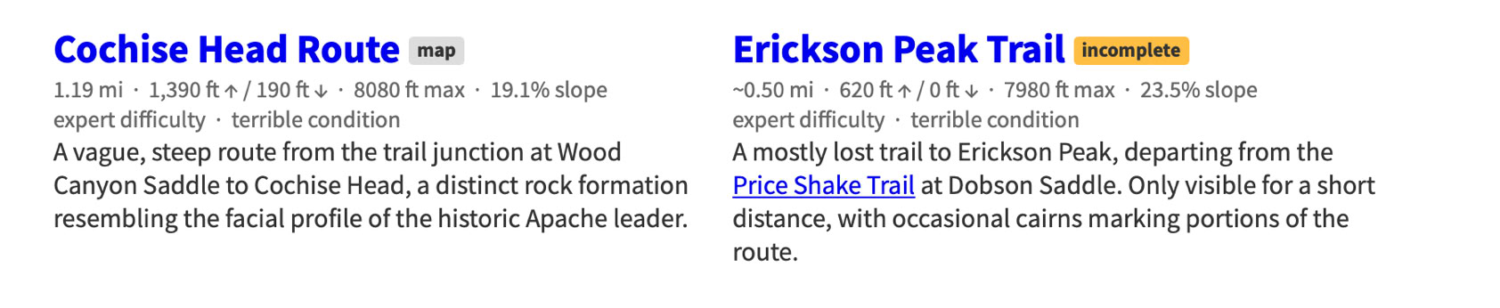
Expert Trails
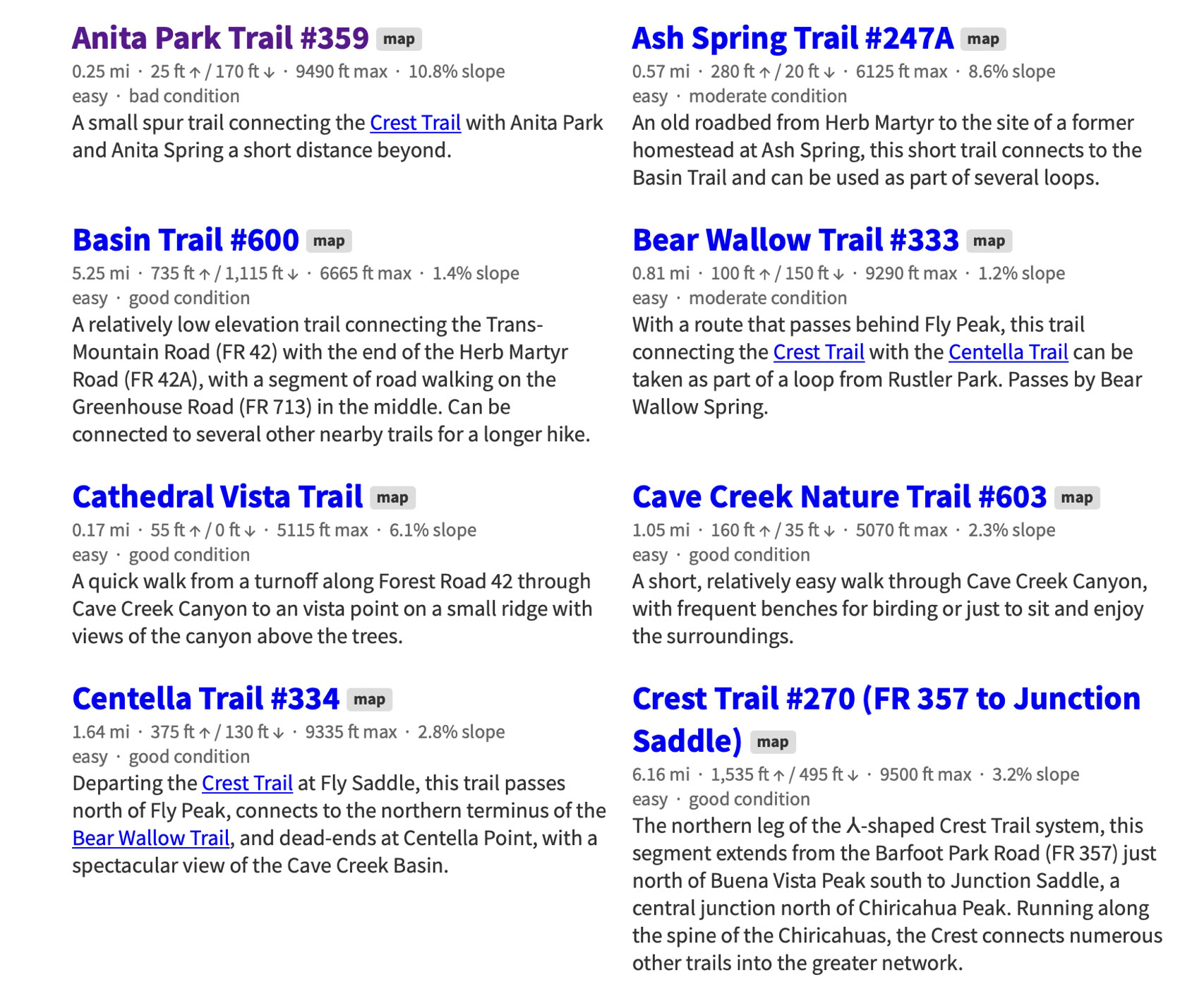
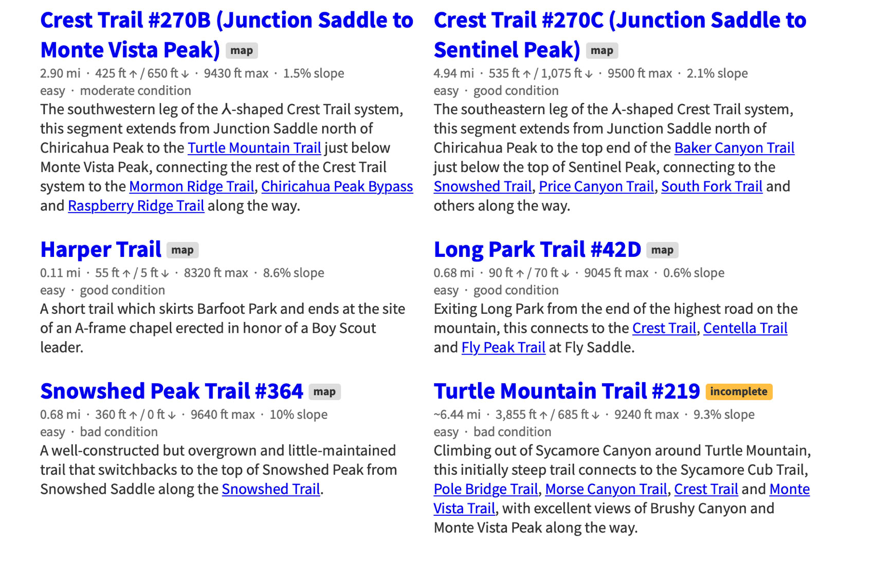
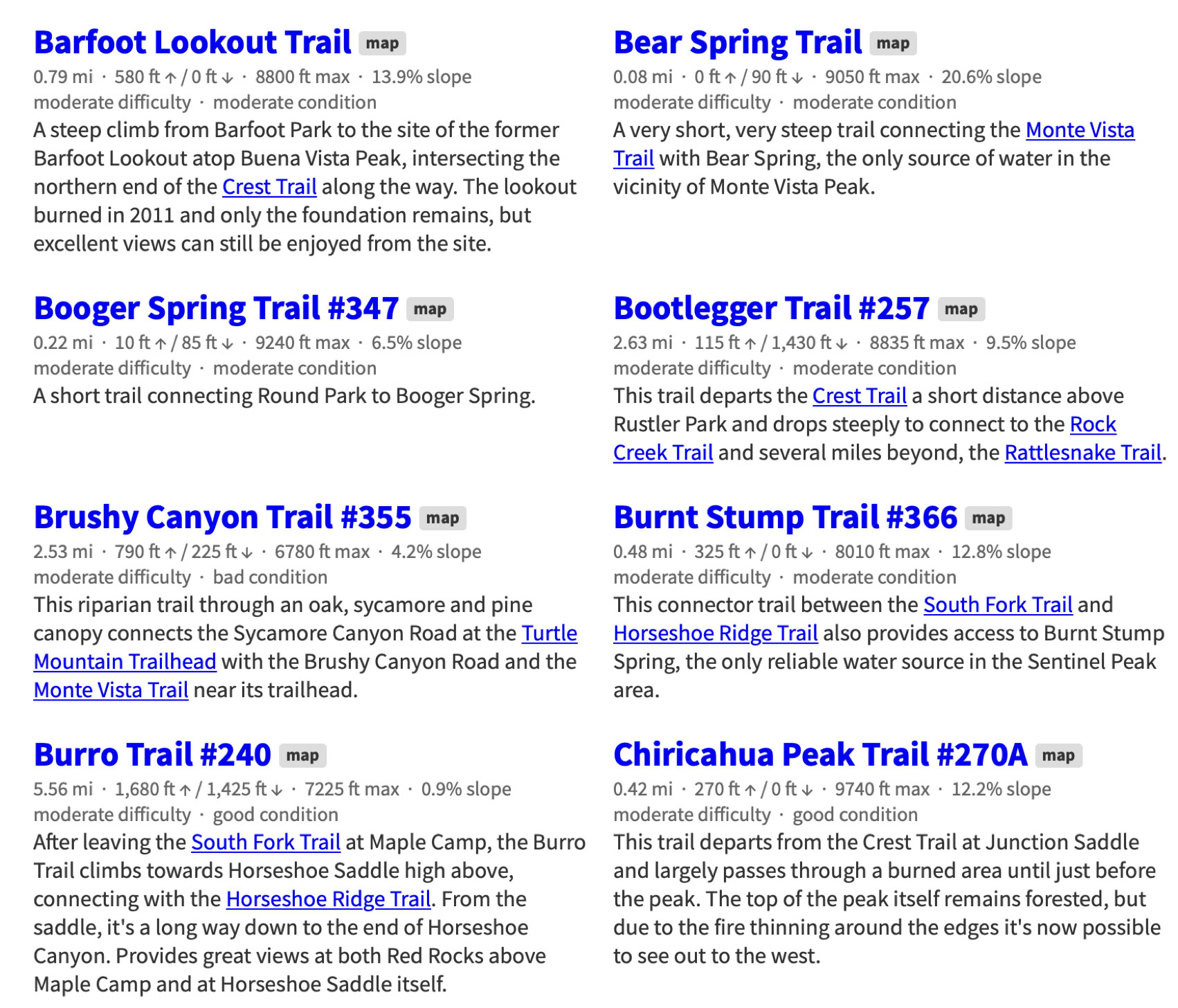
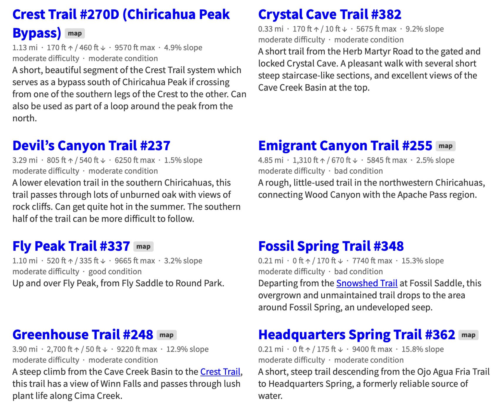
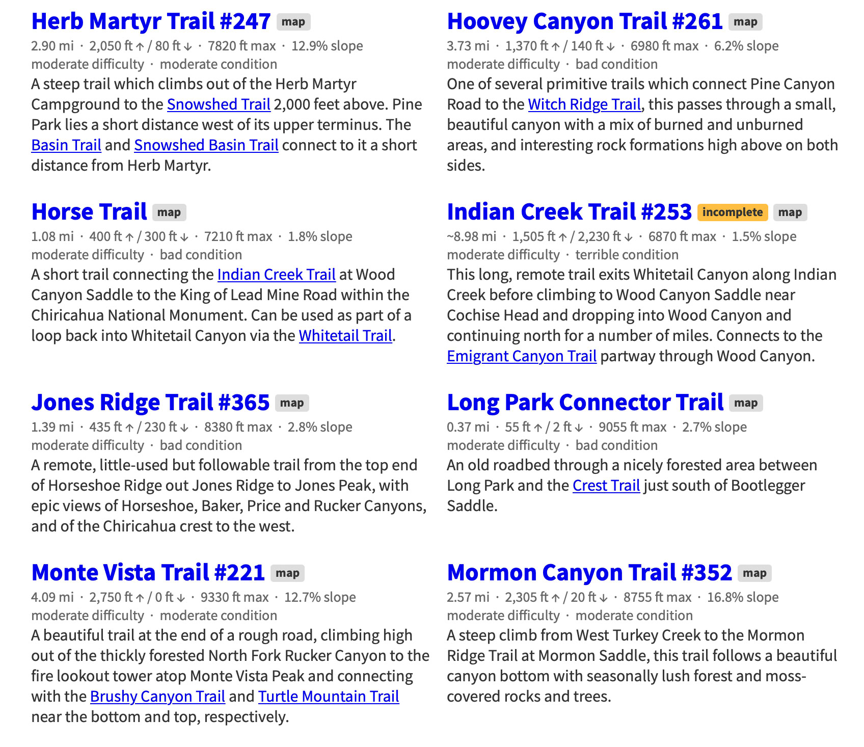
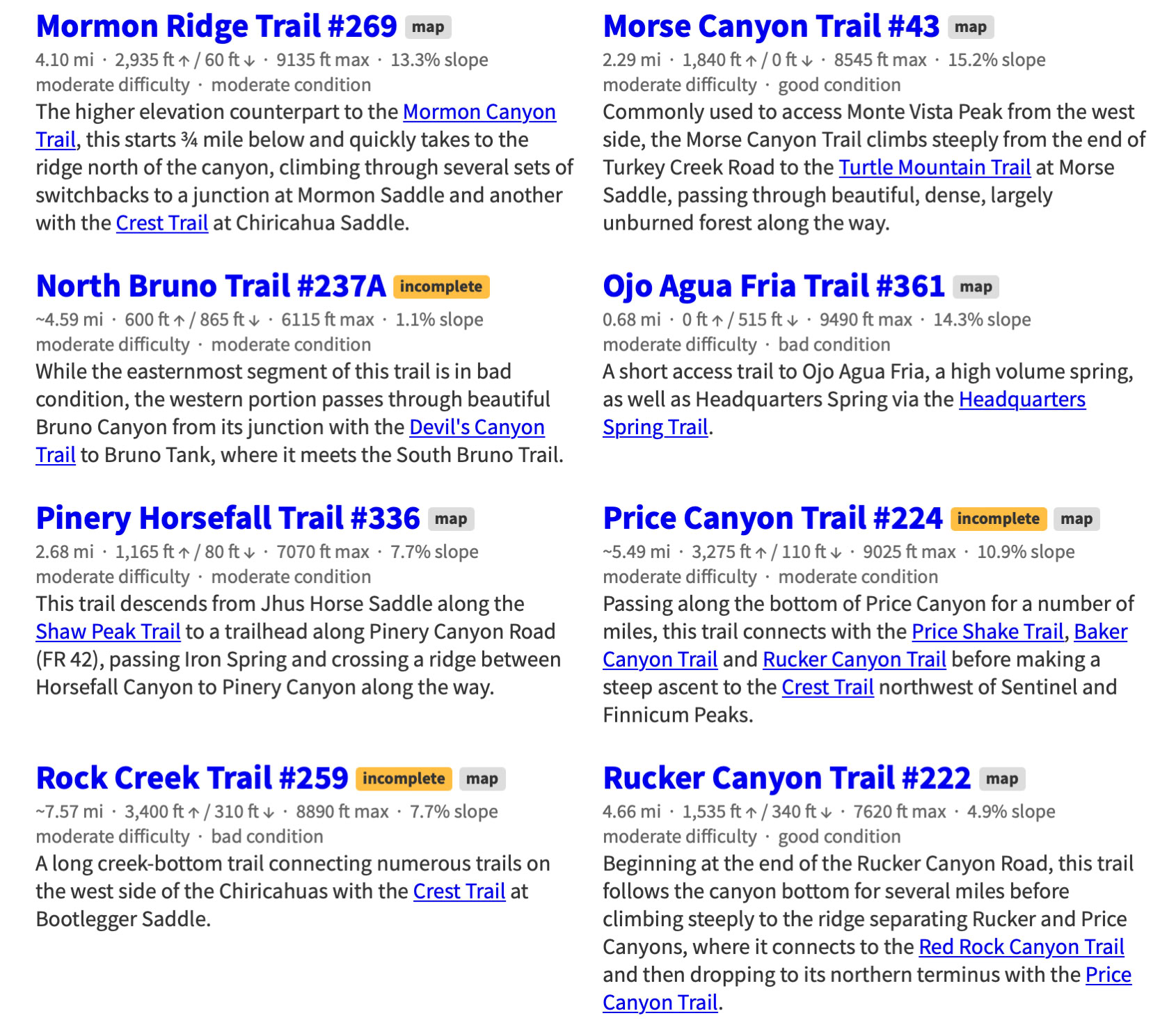
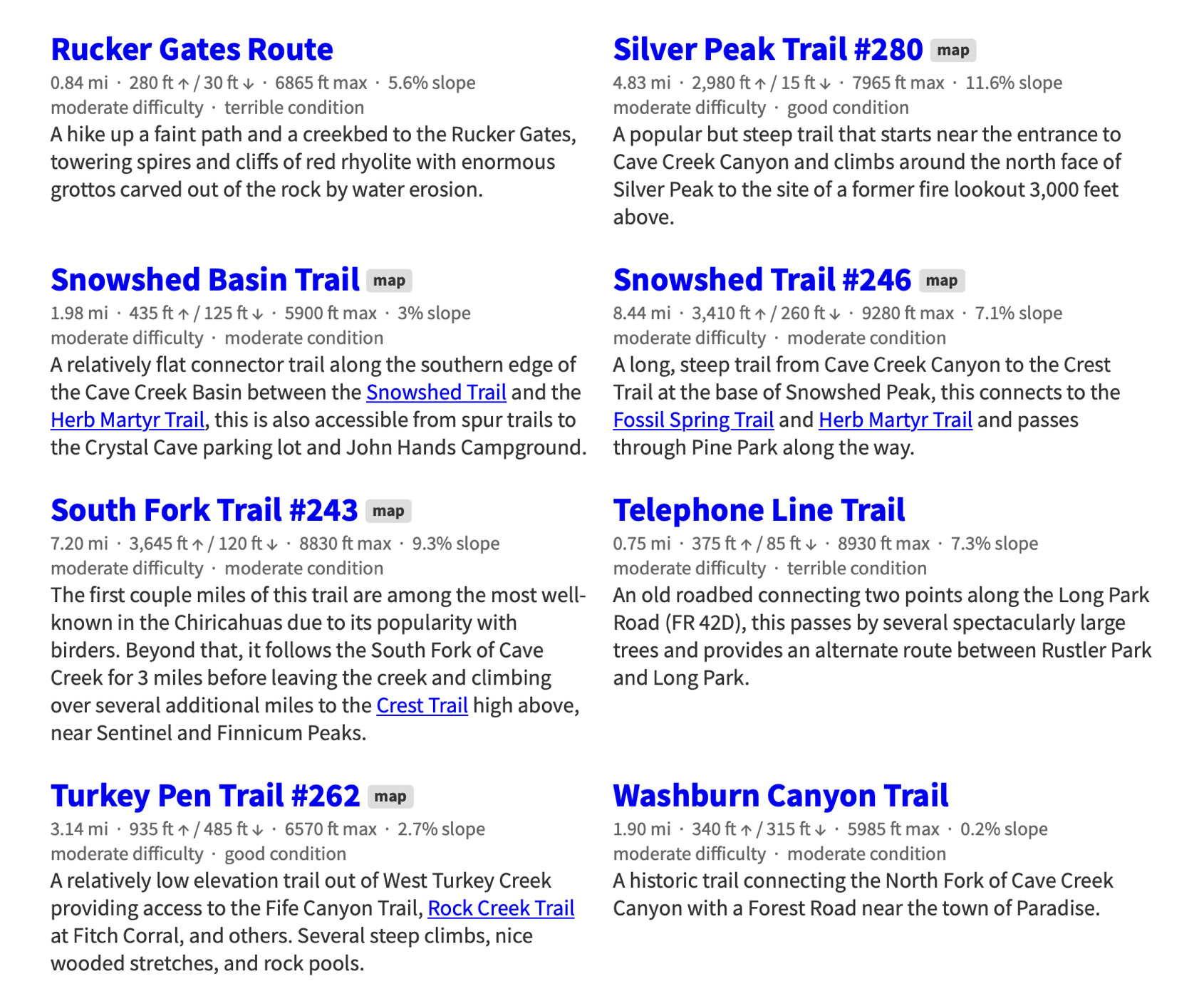
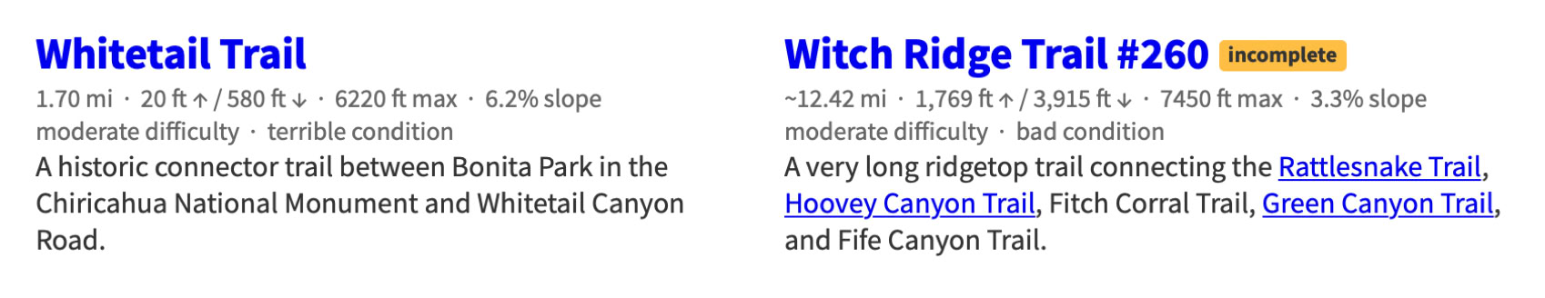
Chiricahua Mountain Hiking Trails
This project -a Herculean task - was started by Jonathan Patt as a collection of GPS data recorded while hiking in the Chiricahua Mountains of Southeastern Arizona starting in 2012 and expanded slowly into this site over a six month period beginning around 2013, during which it became obvious that much of the existing Chiricahua hiking information is out of date and, for some trails, nonexistent. This site is an attempt to resolve that problem.
If you would like to see a map of these trails or want more information about the project visit the Chiricahua Mountains Hiking Trails web site at:
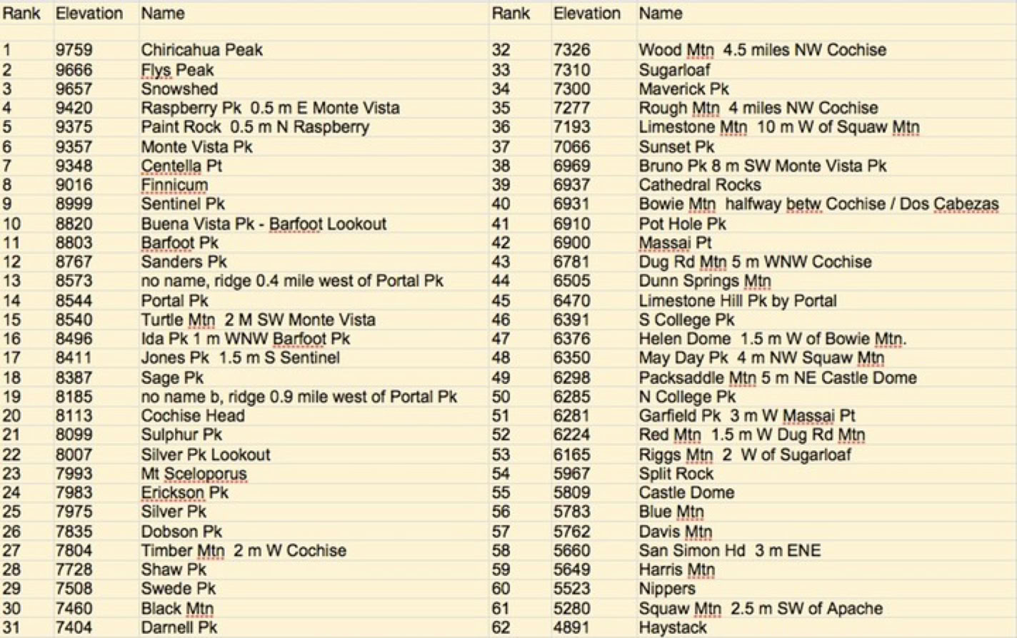
The 62 Highest Peaks, Mountains, Hills, And Lookouts In The Chiricahuas
(Tabulated by Ray Brooks)
(Form Necessary To Work With Trail Crew)
Download - Complete - Mail
To volunteer with the US Forest Service, fill out an application. If accepted, a Volunteer Service Agreement specifying the task(s) will be sent to you.
DOWNLOAD THE FORM. Print it, fill out, sign in block 23, and date. You can scan a signed document and e-mail it toArmando Arvizu at: armando.arvizu@usda.gov
You can also mail the form to Armando at the Douglas Ranger District Office:
1192 W. Saddle View Rd. Douglas, AZ 85607
People can join the list automatically by sending an email to portal-rodeo-hiking+subscribe@googlegroups.com and they should start receiving messages.